Category: Uncategorized

Things to Do in Tazewell, VA for Riders and Drivers

Searching for things to do in Tazewell, VA, usually begins with the sound of an engine on Virginia Route 16. Back of the Dragon brings motorcycle riders and performance-car drivers into town for its mountain curves, elevation changes, and constantly shifting rhythm, but experienced visitors know the trip should not end as soon as the road reaches Main Street.

Your Tazewell adventure starts on Route 16, but the real magic happens when you slow down for the gathering places, side roads, local food, and mountain history that make this trip unforgettable.

Start or finish at the Back of the Dragon Center, trade tight corners for the open valley roads around Burke’s Garden, or take a quieter loop toward Lake Witten. Whether you arrive alone, with a riding club, or behind the wheel of a sports car, Tazewell gives you enough road and local character to make a full weekend out of the trip.
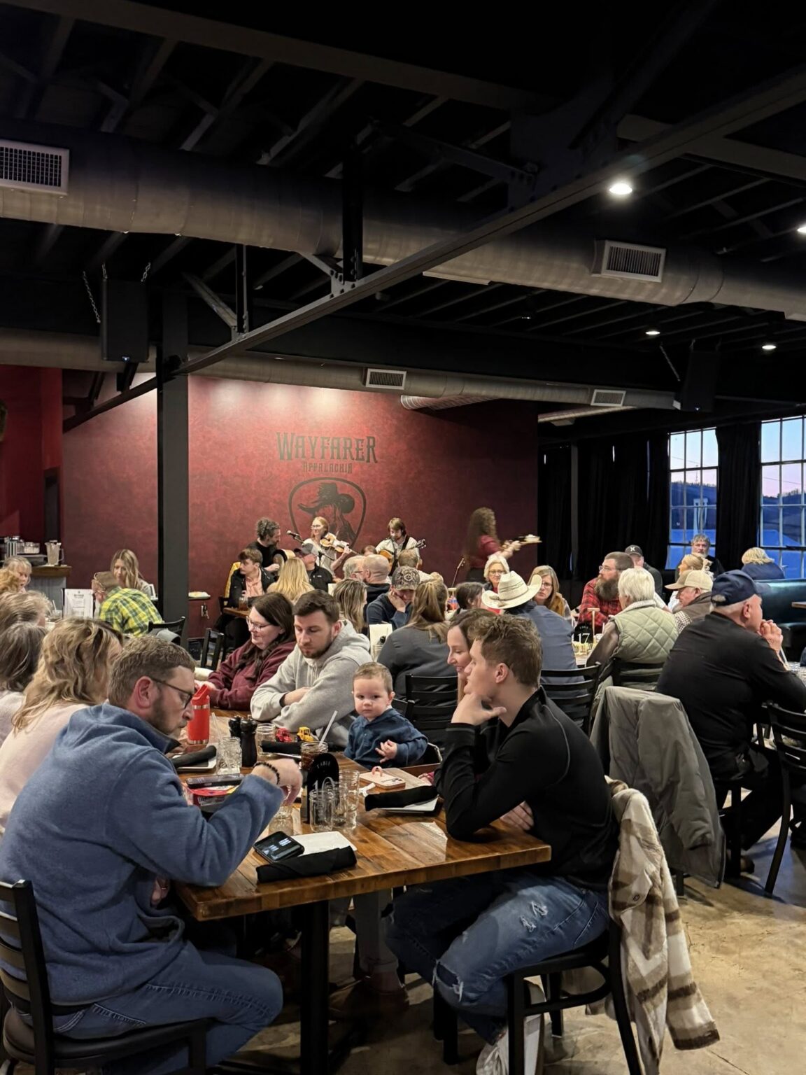
a group of people having a fun dining experience and concert visit in tazewell va near back of the dragon brewery

Ride the Back of the Dragon

Begin Your Route 16 Adventure in Tazewell

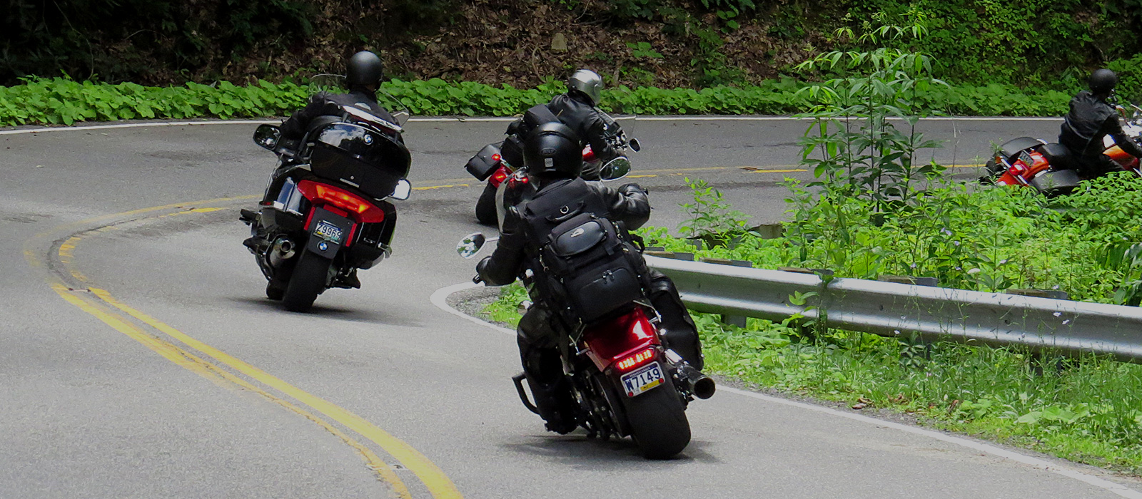
For most enthusiasts, this is the reason they came. Back of the Dragon needs no introduction, only a full tank and a clear head. Back of the Dragon follows a 32-mile section of Virginia Route 16 between Tazewell and Marion, crossing three mountain ranges and delivering more than 400 curves through Southwest Virginia.

The curve count gets attention, but it does not tell the whole story. The real character comes from how quickly the road changes. One section asks for steady braking and a clean line through repeated bends. Another opens just long enough to show the next Appalachian ridge before the road folds back into the mountain.

Local riders know not to judge the entire route by the opening miles outside town. Route 16 tightens, climbs, drops, and changes surface exposure as it moves away from Tazewell. A corner in full sun may be dry while the next shaded section still carries moisture.

Ride your own ride. Back of the Dragon is at its best when you find a smooth rhythm instead of chasing speed, and that’s when the road really comes alive. Stay in your lane, leave margin for local traffic, and save the route stories for Main Street after everyone arrives safely.

Turn the Ride Into a Longer Mountain Loop

A run from Tazewell toward Marion is a great way to anchor your day, and it leaves plenty of room to build something bigger around it. Many riders use Tazewell as their meeting point, make a pass across Route 16, then return for food, fuel, or another loop through the surrounding mountain roads.

Before leaving town, check your tires, brakes, fuel, weather, and available daylight. There is no universal tire-pressure number for Back of the Dragon because the correct setting depends on the motorcycle or vehicle, tire model, load, and manufacturer guidance. Use the recommended cold pressures for your setup rather than copying another rider’s track-day settings.

Mountain weather can also change faster than conditions around Main Street suggest. Rain may move across one ridge while the pavement near the Welcome Center remains dry. After a storm, expect the possibility of runoff, gravel, small branches, or leaves collecting near the edge of a corner.

Groups should choose clear regrouping points before the first rider pulls away. Do not make less-experienced riders chase the front of the pack. The best group run is one where everyone has room to ride their own ride and knows where the next stop will be.

Use the official Plan Your Trip guide when mapping your visit.

Visit the Back of the Dragon Welcome Center

Start or End the Adventure on Main Street

592 Main Street is where the Back of the Dragon community comes to life, with riders and drivers swapping stories after every run. Riders line up outside, drivers compare notes about the route, and first-time visitors get a better sense of what lies beyond the northern end of Route 16.

If you are trailering motorcycles into Tazewell, meeting a club, or waiting for the rest of your group, the center gives everyone an obvious destination instead of trying to coordinate at an unfamiliar fuel stop. It also keeps the start of the day connected to the people and town behind the route.

Inside, you can look over riding information, browse Back of the Dragon merchandise, and talk about current conditions with people familiar with the area. That local conversation can be more useful than a generic route description, especially when weather has moved through the mountains.

After the run, the center becomes the place where everyone compares favourite sections, missed shifts, clean lines, changing conditions, and the view that almost distracted them at the wrong moment.

Stay for Pizza, Brews, and Events

The ride will keep you sharp for 32 miles straight, so when you roll back into Tazewell, it’s time to relax and enjoy it. Dragon Fired Pizza and the Back of the Dragon Brewery make it easy to stay on Main Street instead of immediately climbing back into the truck or heading for the highway.

This is also where the enthusiast-focused character of the destination becomes clear. You are likely to see touring motorcycles, cruisers, sport bikes, roadsters, pony cars, and club groups sharing the same stop, even if they approached Route 16 in completely different ways.

The venue hosts live music, rallies, ride gatherings, and community activities throughout the year. Check the current events calendar before travelling because schedules can change.

Planning around an event can turn a quick route run into a full Tazewell weekend. It also gives the group somewhere to gather after the helmets come off and the engines cool down.

Explore Downtown Tazewell

Walk Main Street After the Engines Cool

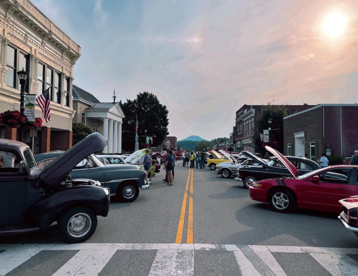
Downtown Tazewell isn’t just a stop on the way to somewhere else. It’s part of the Back of the Dragon experience itself. Main Street is part of the route culture, with the Welcome Center acting as a gathering point for people arriving from Route 16 and the surrounding Southwest Virginia roads.

After riding technical corners for much of the day, walking a few blocks gives your hands, shoulders, and concentration a chance to reset. Stop for a meal, look through local businesses, or take time to see the historic streetscape rather than treating the town as nothing more than a place to refuel.

The pace is noticeably different from the mountain. On Route 16, your attention stays on lane position, corner entry, surface changes, and traffic. On Main Street, you can finally look around, talk with your group, and decide whether the day needs another run or a slower finish.

This stop is perfect for mixed groups too, giving everyone a place to land no matter how they like to spend the day. Not everyone wants to repeat the Dragon immediately, and some passengers or family members may prefer food, shopping, or a relaxed walk while the most committed riders discuss another pass.

Check individual business hours before arriving, particularly on quieter weekdays or outside the main riding season.

a scenic drive near back f the dragon in tazewell

Take a Scenic Drive Through Burke’s Garden

Trade Tight Curves for Open Valley Views

Just when you think you’ve seen all of Tazewell County, Burke’s Garden opens up a view unlike anything on Route 16. The high-elevation valley is enclosed by mountains, creating the broad, bowl-like landscape often associated with “God’s Thumbprint.”

The approach from Tazewell replaces the concentrated rhythm of Route 16 with rural roads, farmland, long views, and a much slower tempo. That contrast makes Burke’s Garden one of the most worthwhile attractions near Back of the Dragon, especially after a morning spent working through technical bends.

Local riders treat the valley as a community, not as an extension of a closed-course route. Expect farm equipment, residents entering driveways, cyclists, wildlife, and vehicles travelling at local-road speeds. Give agricultural traffic room and keep exhaust noise respectful near homes, farms, and churches.

The road deserves attention even when the scenery opens up. Sightlines can change around rises, and animals or slow-moving vehicles may appear with little warning.

Burke’s Garden is best enjoyed when you stop trying to collect miles and let the valley set the pace.

Add an Artisan or Local Food Stop

Don’t just ride through Burke’s Garden. Stop, browse the local goods, and take a piece of the valley home with you. Depending on current opening schedules, visitors may find regional crafts, Amish-made foods, baked goods, and other products connected to the valley.

Small rural businesses may keep limited or seasonal hours, so call or check current information before building the day around a specific stop. Cash may also be useful in areas where smaller establishments do not offer the same payment options as larger businesses in town.

The detour works particularly well on the second day of a Tazewell VA motorcycle trip. Instead of repeating the same pace and level of concentration, riders can enjoy a less demanding route while still staying surrounded by the mountains that define the region.

Do not overload this part of the itinerary. Burke’s Garden is memorable because of its open space, working landscape, and quiet roads, not because it offers a long checklist of attractions.

Discover Tazewell County’s History

Visit the Historic Crab Orchard Museum

Every rider who visits the Historic Crab Orchard Museum comes away seeing Tazewell County a little differently, with a real sense of the people and places behind the road. Exhibits connect the region’s Appalachian heritage with the lives of the people who worked and travelled through this terrain long before Route 16 became an enthusiast destination.

For riders, the museum also provides a practical weather alternative. When fog settles along the ridges or rain makes another mountain run a poor decision, an indoor history stop is more worthwhile than waiting beside the bikes and hoping the road dries immediately.

The visit can change how you see the surrounding landscape. Barns, historic buildings, old routes, and mountain gaps feel less like scenery once you understand how they shaped local work, travel, and settlement.

It is a useful reminder that the roads did not create Tazewell. They run through a community with a much longer story.

Connect the Town’s Past With Its Road Culture

Before Back of the Dragon put Tazewell on the map, this town had its own story, rooted in agriculture, mountain settlement, and the Pocahontas coalfield region. Its more recent identity also includes the riders, drivers, clubs, and events drawn to Virginia Route 16.

The Back of the Dragon story came from local recognition of a road that enthusiasts already enjoyed but that had not yet been developed into a widely known destination. The name reflects the way the mountain ranges cross the route like the raised sections along a dragon’s back.

That origin is important because it separates Back of the Dragon from a road selected by an outside travel writer. The identity grew from people who understood the terrain, saw the potential of Route 16, and wanted visitors to experience both the road and Tazewell.

Today, Main Street carries both parts of that story. It remains a small-town centre while also serving as the northern gathering point for one of Virginia’s best-known enthusiast routes.

Spend Time Outdoors Around Tazewell

Stop at Lincolnshire Park

Lincolnshire Park is the perfect nearby escape when you want to step away from the engines without leaving Tazewell behind. The park is built around Lincolnshire Lake and sits close enough to town to work as a practical stop before checking into lodging, meeting family members, or deciding whether conditions are right for another run.

Instead of treating it like a generic roadside stretch break, use the park as a proper reset. Walk near the lake, loosen up after repeated mountain corners, drink water, and assess whether the group still has the focus for more technical riding.

The setting also suits travellers who came to Tazewell with partners, children, or friends who are not spending the entire day on Route 16. It gives them a local outdoor option while riders organise the next part of the trip.

Because Lincolnshire Park is near town rather than deep in the route, it can also be useful when clouds are sitting on the higher ridges. Conditions around the lake may give you a break, but they should not be used as proof that Route 16 is clear.

Explore Cavitt’s Creek Park and Lake Witten

For a change of pace, Cavitt’s Creek Park and Lake Witten offer wooded trails and a peaceful 52-acre lake tucked away from the Dragon’s curves.

The lake supports activities including hiking, camping, paddling, and boating with electric motors. For an enthusiast group, that makes the park more than a place to stand beside the motorcycles for ten minutes. It can become a genuine half-day break during a multi-day trip.

The ride toward the park also reminds visitors that Tazewell County is not defined by one famous road. Forested local routes, creek valleys, and changing elevation continue beyond the main Back of the Dragon corridor.

Check current access, facility, and weather information before visiting, especially when planning to camp or launch a boat. Heavy rain can affect both park plans and the smaller roads used to reach outdoor areas.

After several hours of technical riding, spending time beside Lake Witten can provide the mental reset needed to enjoy the next run rather than simply enduring it.

Plan Your Tazewell Motorcycle or Driving Trip

Choose the Right Season and Riding Window

Every season brings its own version of Back of the Dragon, and local riders know there’s more to the decision than just the month on the calendar. Conditions on Main Street, along Route 16, and near the higher ridges can feel different on the same day.

In spring, rainwater may continue crossing or collecting near shaded mountain sections after roads closer to downtown appear dry. New growth can also reduce visibility around some bends as the season progresses. Check the forecast, but pay equal attention to the pavement in front of you.

Summer gives riders longer daylight, yet afternoon storms can build over the Appalachian terrain and move across the route quickly. Valley heat around Tazewell does not guarantee the same temperature or visibility after Route 16 gains elevation.

Fall brings colourful ridgelines and heavy enthusiast traffic, but it also brings shorter daylight, leaf debris, and shaded corners that may remain damp. A layer of wet leaves can reduce grip and hide gravel or uneven pavement.

Winter conditions can include freezing temperatures, ice, snow, road treatment, and debris from repeated freeze-and-thaw cycles. Do not assume a clear day in town means the entire mountain route is suitable.

Before departure, check road conditions through 511 Virginia. Leave enough daylight to finish without rushing unfamiliar corners, and be willing to change the plan when the mountain gives you a reason.

Build a Full Tazewell Itinerary

Build your Tazewell itinerary around Route 16, but don’t stop there. The best trips leave room for everything the mountains have to give.

Begin at the Back of the Dragon Center on Main Street. Meet the group, check fuel and equipment, review the route, and make sure everyone understands the next regrouping point. New riders should not feel pressured to match the quickest person in the group.

Ride Virginia Route 16 toward Marion, allowing enough time to adjust to the road instead of attacking the opening section. Stop only in safe, legal areas, and stay aware that residents and working vehicles use the same route.

Return to Tazewell for pizza, drinks, an event, or time downtown. The next morning, choose a different rhythm with Burke’s Garden, Lincolnshire Park, Cavitt’s Creek Park, Lake Witten, or the Historic Crab Orchard Museum.

Clubs and larger groups can use the official club and group trip information when organising their visit.

The best Tazewell VA motorcycle trip is rarely the one with the tightest schedule. Leave room for weather, a longer conversation on Main Street, a slower rider, or an unexpected local stop. Those unplanned moments are often what turn a good route into a trip worth repeating.

Frequently Asked Questions

What are the best things to do in Tazewell, VA for motorcycle riders?

Begin with Back of the Dragon on Virginia Route 16, then spend time at the Back of the Dragon Center on Main Street. Riders can also add Burke’s Garden, Lincolnshire Park, Cavitt’s Creek Park, Lake Witten, downtown Tazewell, and the Historic Crab Orchard Museum to create a fuller trip.

What attractions are near Back of the Dragon?

Nearby attractions include the Back of the Dragon Center, downtown Tazewell, Burke’s Garden, the Historic Crab Orchard Museum, Lincolnshire Park, Cavitt’s Creek Park, and Lake Witten. Together, they offer scenic roads, local food, history, outdoor space, and quieter breaks between mountain runs.

Can sports-car drivers enjoy the Back of the Dragon?

Yes. Route 16 attracts sports-car drivers as well as motorcycle riders because of its changing elevation and varied corners. Drivers should stay in their lane, maintain a pace that allows for changing surface conditions, and remember that local residents, trucks, motorcycles, and other road users share the route.

Is Burke’s Garden worth adding to a Tazewell motorcycle trip?

Yes. Burke’s Garden provides a slower, more open riding experience than the tighter mountain rhythm of Route 16. Its high-elevation valley, farms, rural roads, and surrounding ridgelines make it a strong second-day route. Ride respectfully because it is also a working agricultural community.

How many days should I spend in Tazewell?

One day allows time for Back of the Dragon and a stop on Main Street. Two or three days are better for riders who also want to explore Burke’s Garden, local parks, historical sites, events, and other Southwest Virginia roads without rushing every stop.

Plan Your Back of the Dragon Adventure

The road may be what brings you to Tazewell, but the town, mountain communities, and gathering places complete the experience. Build the trip around Route 16, leave room for Main Street and Burke’s Garden, and give yourself enough time to enjoy the road without forcing the pace.

Explore Back of the Dragon and start planning your next Southwest Virginia run.
Back of the Dragon Map & GPX Download

The Road Awaits. Grab the Back of the Dragon map, load the Back of the Dragon GPX route, and get ready for Virginia Route 16 through Southwest Virginia. This run between Tazewell and Marion brings tight switchbacks, steep climbs, long drops, and the kind of curves riders talk about long after the engines cool.

A GPX route is a downloadable GPS file that helps riders and drivers follow a mapped route using a compatible navigation app or GPS device. For the Dragon, that means you can load the route before you get into the mountains, check the turns ahead of time, and keep your focus on the road instead of guessing at every bend.

This is for riders, sports car drivers, club leaders, and road-trip travelers who want to know the route before the engine warms up.

Download the Back of the Dragon GPX Route

The Back of the Dragon GPX route gives you a clean way to follow the main VA-16 ride without relying only on cell service. That matters here. Once you leave the town streets and start climbing into the mountain sections, service can fade, the road gets busy with curves, and stopping to fix a route on your phone gets old fast.

Load the GPX file into your GPS unit or route-planning app before you leave your hotel, cabin, or meet-up spot. If you are riding with a group, send the file out early so everyone has the same route saved before kickstands go up.

Keep a backup map handy, too. The Dragon has plenty of places where you will want your eyes up, not buried in a screen. A good route file keeps the day simple: start prepared, ride focused, and enjoy the road.

Download the GPX Route

Back of the Dragon Route 16 GPS Map

The Route 16 GPS map helps you see the Dragon as a real mountain road, not just a line between two towns. From Tazewell, VA to Marion, VA, the route crosses rugged Southwest Virginia terrain with a mix of tight corners, sweepers, short straights, shaded pavement, and ridge-top views.

The ride carries you over three mountain ranges, including Clinch, Brushy, and Walker Mountain. That is why the route feels different from mile to mile. One section may open into a view across the Appalachian ridges. The next may tuck into tree cover with a sharp turn waiting on the other side.

Use the map to understand the flow before you ride. Check where you want to start, where you want to stop, and how much time you want to leave for photos, fuel, food, and a breather after the tighter sections.

For more trip details, visit Plan Your Trip.

Tazewell, VA Starting Point

Tazewell is the northern hub and a natural place to gather before the ride. Riders often meet near Main Street, check their route, grab food or drinks, and make sure the whole group is ready before heading south on VA-16.

Starting in Tazewell gives you the classic “roll out from town, climb into the mountains” feel. It also puts you close to the Back of the Dragon store, photos, merchandise, and the local rider energy that makes the route more than just pavement.

Marion, VA Southern Access

Marion gives riders and drivers a strong southern access point, especially if you are coming from I-81 or staying near Hungry Mother State Park. This side can feel like a quieter launch into the Dragon, with the road building from the Marion area into the mountain sections.

Some riders run Marion to Tazewell, then stop at the Back of the Dragon hub. Others start in Tazewell and finish near Marion before looping into the rest of Southwest Virginia. The GPX route helps either direction stay simple.

How to Use the Downloadable Ride Route

Download the GPX file before you reach the mountain corridor. Open it in your navigation app or GPS device, then confirm the route follows VA-16 between Tazewell and Marion. Do not wait until you are already on the shoulder trying to fix settings while your group is ready to roll.

For motorcycle clubs and sports car groups, share the route before the trip so the whole line knows the same plan before leaving town. On the Dragon, a photo stop, a slow-moving vehicle, or a regroup near one of the pull-off areas can spread riders out quickly. When everyone has the same route loaded, the day feels smoother and safer.

Use the map as a guide, not a substitute for road sense. The Dragon has curves that tighten quickly, shaded sections that can hold moisture longer, and grades that make speed feel different than it does on a flat road. Load the route, then ride the road in front of you.

Download the GPX Route

What to Know Before Riding Route 16

Back of the Dragon rewards riders who respect the terrain. VA-16 is not a simple scenic bypass. It climbs, drops, and bends over mountain ground, with sections that ask for steady throttle control, clean braking, and patience through the tighter switchbacks.

Watch the shaded areas, especially after rain or during cooler mornings. Southwest Virginia weather can change fast in the ridges. A clear start in Tazewell can still turn into fog, damp pavement, or cooler air as the road climbs. In fall, leaves can collect in corners. After storms, small gravel and wash can show up where water crosses the road.

Before hitting the pavement, check the Virginia Department of Transportation 511 system for active road work, incidents, or seasonal maintenance updates on VA-16. First-time riders should also study the map, learn the shape of the route, and give themselves room. The best ride is the one where you enjoy the corners, take in the overlooks, and still have enough energy left to talk about it afterward.

For more first-time guidance, read Back of the Dragon Safety Tips for First-Time Riders.

Why Choose Back of the Dragon for Your Route Planning

Back of the Dragon is not just a road name on a GPS screen. It is a Southwest Virginia riding destination shaped by the towns, mountains, businesses, and riders who keep coming back.

Planning through the official Back of the Dragon experience gives you more than a route file. You can connect the map with lodging, trailer parking, food, drinks, ride photos, group trip planning, and the Main Street stop in Tazewell. That local context helps, especially if you are bringing a club or traveling in from out of state.

A generic map can point you toward VA-16. Back of the Dragon helps you understand how the ride fits together: where to meet, where to start, what the road feels like, and how to build a full day around the Dragon instead of rushing through it.

To learn more about the road itself, visit The Road. To see how the Dragon became a Southwest Virginia riding destination, visit Our Story.

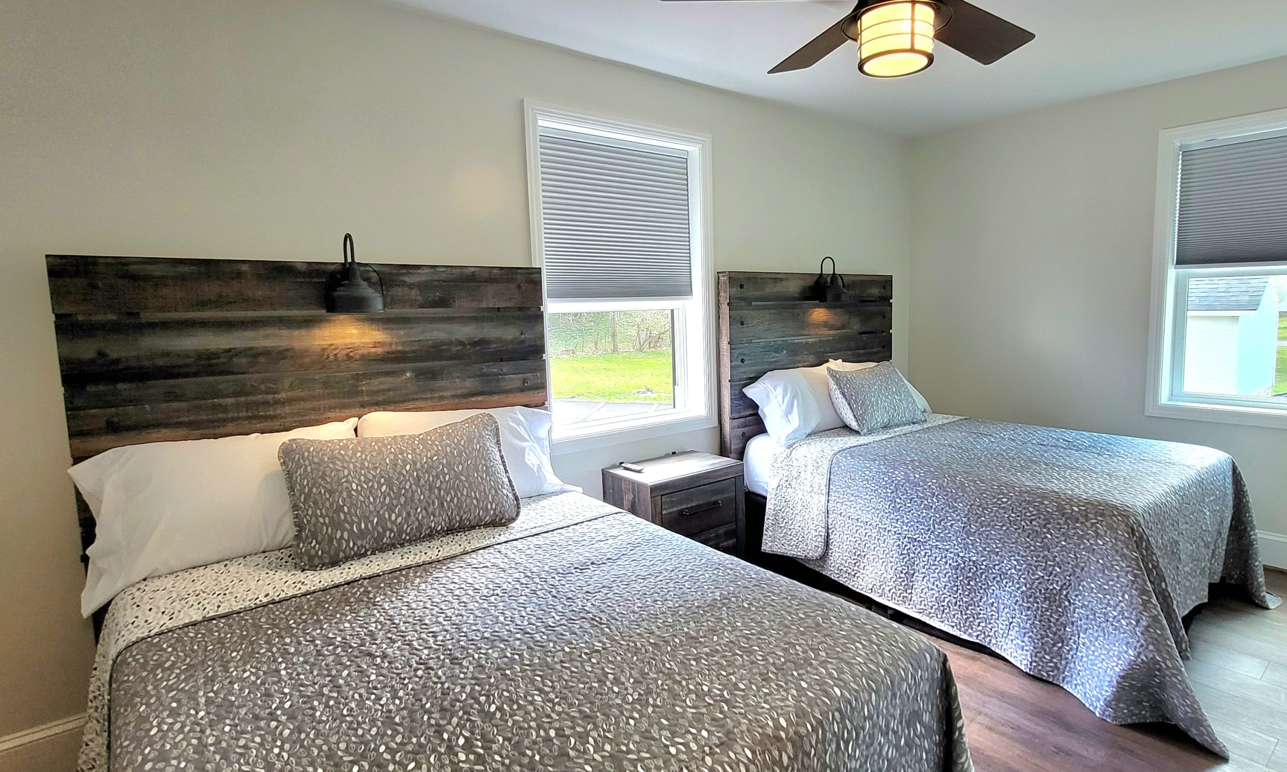
rentals near back of the dragon plan your trip

Plan Your Back of the Dragon Trip

A good Dragon run starts before the first curve. Once your map and GPX route are ready, think through the rest of the day: where you are staying, where the group is meeting, where you will park, and whether you want to ride the route one way or build a loop through Southwest Virginia.

Riders often plan around Tazewell, Marion, Hungry Mother State Park, Burke’s Garden, and nearby Appalachian backroads. If you are trailering bikes or traveling with a car club, sort out parking and lodging before you arrive. It keeps the morning easier and gives you more time for the ride.

Leave room in the schedule for more than pavement. Stop for photos, grab pizza or a drink, check out the store, and give yourself time to cool down after the mountain sections. The Dragon is the main event, but the towns and stops are part of the story.

Service Area

Back of the Dragon serves riders, drivers, clubs, and road-trip travelers visiting Southwest Virginia for the VA-16 route between Tazewell and Marion.

The core route connects the Tazewell side of the mountains with the Marion side near Hungry Mother State Park. Many visitors also build the trip around Burke’s Garden, Clinch Mountain, and the Jefferson National Forest, part of the George Washington and Jefferson National Forests managed by the U.S. Forest Service. That public-land setting is part of what gives this region its wooded ridges, quiet backroads, and true Appalachian feel.

If you are coming from outside the region, load the GPX route before you arrive and check your day plan while you still have strong service. The road is easy to find when you know where you are going, but the mountain setting makes preparation part of the ride.

Frequently Asked Questions

Where can I find the Back of the Dragon map?

You can use the Back of the Dragon map to plan the VA-16 ride through Southwest Virginia. It helps you see the full run between the Tazewell and Marion access points before you arrive. Riders use it to plan meet-up spots, stops, direction of travel, and timing for the day.

Can I download a Back of the Dragon GPX file?

Yes. The Back of the Dragon GPX file gives you a downloadable ride route for compatible GPS devices and navigation apps. Save it before your trip, open it once to make sure it loads, and keep a backup map in case service drops in the mountain sections.

What road is Back of the Dragon on?

Back of the Dragon follows Virginia Route 16 in Southwest Virginia. The road is known for mountain grades, switchbacks, hairpins, scenic views, and hundreds of curves. It is popular with motorcycle riders, sports car drivers, and group road trips.

Where does Back of the Dragon start and end?

The route runs between Tazewell, VA and Marion, VA. Tazewell is the northern hub with the Back of the Dragon stop on Main Street. Marion gives riders southern access near I-81 and Hungry Mother State Park.

Is the Route 16 GPS map helpful for first-time riders?

Yes. The Route 16 GPS map is especially helpful if you have never ridden the Dragon before. It lets you understand the direction, length, access points, and mountain layout before you arrive. First-time riders should still ride at their own pace and treat the map as a planning tool, not a reason to rush.

Ride the Dragon Your Way

Load the map. Download the GPX route. Check your stops. Then come ride the mountain road that keeps Southwest Virginia on the bucket list for riders and drivers.

Back of the Dragon is for people who love curves, clean mountain air, small-town stops, and a road that feels earned by the time you finish it.

Download the GPX Route

Sports Car Roads in Tazewell, VA

The best sports car roads Virginia enthusiasts seek are roads that combine driver engagement, changing scenery, and memorable destinations. The Back of the Dragon sports car drive delivers exactly that. This 32-mile stretch of Virginia Route 16 runs between Tazewell and Marion, Virginia, crossing the elevations and ridgelines of Clinch Mountain through the heart of Southwest Virginia. 

Drivers travel here for sweeping corners, technical mountain sections, dramatic elevation changes, and the Appalachian scenery that has made this one of the most talked-about driving roads on the East Coast.

Back of the Dragon follows Virginia Route 16 through Tazewell County and Smyth County and is known for its more than 400 curves, changing elevations, and constantly evolving views. Sports car owners, grand touring enthusiasts, and exotic car drivers visit from across the region to experience one of the premier mountain driving roads Virginia has to offer while exploring destinations like Burke’s Garden, Jefferson National Forest, and the mountain communities surrounding the route.

Before heading into the curves, explore the complete Back of the Dragon experience and begin planning your Southwest Virginia driving adventure.


Why Sports Car Enthusiasts Choose Back of the Dragon

Performance Driving Meets Appalachian Scenery

Some roads are built to get you somewhere. Back of the Dragon is built around the drive itself. Sports car owners are drawn to Virginia Route 16 because the road creates a rhythm that rewards smooth steering inputs, controlled braking, and careful pacing through changing mountain terrain.

Drivers leave Main Street Tazewell and immediately begin climbing toward the Clinch Mountain ridgeline, where the road transitions from valley sweepers into increasingly technical mountain sectors before reaching Valley View Overlook. This progression gives drivers a clear sense of movement through the landscape rather than simply traveling from one point to another.

The route moves between tight technical sectors and expansive mountain views as drivers climb and descend Clinch Mountain. One moment you are navigating a series of connected corners, and the next opens into long views across Appalachian ridgelines stretching beyond Tazewell County.

For many drivers, the combination of engagement and scenery is what separates this route from more common scenic highways throughout the region.

More Than 400 Curves Across Clinch Mountain

Driving the Back of the Dragon is less about total curve count and more about how the road evolves across Clinch Mountain. Unlike many scenic drives, Virginia Route 16 forces drivers to continuously adapt to changing elevations, corner radii, pavement conditions, and visibility zones.

Route Progression: Tazewell Staging Area → Clinch Mountain Ascent → Valley View Overlook → Marion Descent toward Hungry Mother 

Leaving Main Street in Tazewell, drivers begin climbing the north face of Clinch Mountain through dense Appalachian hardwood canopy. This shaded section develops its own microclimate, where moisture can remain trapped on pavement long after sunrise. Even during warm summer mornings, shaded apexes may retain damp conditions that affect front-end grip and braking confidence.

Near the Valley View Overlook, the route opens dramatically as drivers approach the mountain crest and cross toward Smyth County. Here, the road becomes faster and more flowing, with sweeping transitions that generate sustained lateral loading through the chassis. Visibility improves significantly, but limited guardrail sections and steep drop-offs reward disciplined lane positioning.

The final descent toward Marion and the Hungry Mother corridor presents some of the most technical driving on the route. Consecutive first-gear switchbacks increase brake thermal load while steep drainage cuts and abrupt elevation changes require careful line selection, particularly for lower-slung performance cars and long-wheelbase exotics.

What Makes Back of the Dragon One of the Best Sports Car Roads in Virginia

Technical Corners, Chassis Loading, and Elevation Changes

One reason Back of the Dragon stands out among sports car roads Virginia enthusiasts discuss is how frequently vehicle dynamics change throughout the route.

Drivers encounter rapid transitions between compression zones, cresting sections, off-camber corners, and downhill braking zones. Rather than relying on raw horsepower, the road rewards smooth weight transfer management, progressive steering inputs, and proper corner setup.

Sports cars with balanced chassis characteristics often feel especially composed through the mid-mountain sectors where consecutive directional changes generate sustained lateral G-forces. Drivers quickly learn that carrying momentum through the corner sequence is often more rewarding than accelerating aggressively between curves.

For enthusiasts who appreciate vehicle feedback, suspension response, steering precision, brake consistency, and chassis balance, the experience becomes as memorable as the scenery itself.

Scenic Mountain Driving Without Interstate Traffic

Many sports car owners seek roads that offer both driving enjoyment and a sense of escape. Back of the Dragon provides that experience by moving drivers away from heavy interstate traffic and into the Appalachian landscape surrounding Clinch Mountain.

Mountain forests, ridgelines, valleys, and changing elevations create an environment where the drive becomes the main attraction. During fall, changing foliage transforms sections of the route into one of the most visually striking scenic driving roads East Coast travelers can experience.

A Driver-Focused Experience

Back of the Dragon attracts a wide variety of vehicles because the route appeals to drivers who enjoy the road itself. We regularly see Corvette, Porsche, BMW M, Mustang, Audi RS, Mercedes-AMG, and exotic-car groups using Tazewell as a staging point before tackling Virginia Route 16.

In our experience, first-time visitors are often surprised by how engaging the route becomes once they enter the Clinch Mountain sectors. The combination of corner variety, changing elevations, mountain scenery, and constantly shifting vehicle dynamics creates a driving experience that remains memorable long after the trip ends.

To better understand the route before your visit, take time to explore the full Route 16 drive and map out your preferred stops.

event

What to Expect Along the Drive

Scenic Overlooks and Appalachian Views

The landscape changes constantly throughout the route. Some stretches feel enclosed by mountain forests while others open into broad views across valleys, ridgelines, and the surrounding Appalachian terrain.

Drivers moving through Clinch Mountain frequently encounter overlooks that provide long-distance views across Southwest Virginia. The Valley View Overlook remains one of the most recognizable stopping points along the route, giving drivers an opportunity to appreciate both the mountain scale and the elevation they have climbed. These changing perspectives help make the route feel larger than its 32-mile length.

Burke’s Garden and Nearby Detours

Many visitors extend their drive beyond Virginia Route 16 by incorporating nearby destinations into their itinerary. Burke’s Garden, often called the “Heart of the Dragon,” remains one of the most popular side trips because of its unique mountain basin setting and scenic approach roads.

Jefferson National Forest also provides opportunities for additional exploration, making the area appealing for full-day and multi-day driving adventures.

Road Conditions, Microclimates, and Driver Awareness

Virginia Route 16 rewards attentive drivers because conditions can change significantly within a matter of miles.

The northern slopes of Clinch Mountain feature a dense hardwood canopy that traps moisture and limits sunlight exposure. As a result, shaded pavement sections can remain slick well into the day even when temperatures exceed 80 degrees elsewhere in Southwest Virginia.

In our experience, drivers frequently notice the difference when transitioning from the exposed ridgeline sections near Valley View Overlook back into heavily shaded mountain sectors. Pavement temperatures, available grip, and visibility conditions can change surprisingly quickly.

The descent toward Marion contains several tight first-gear switchbacks where visibility narrows before opening into longer sweepers farther down the mountain. Drivers should also monitor for gravel deposits near logging access roads after storms, particularly around pull-off areas and lower mountain drainage channels.

Before entering the route, consult the Virginia Department of Transportation for road conditions, maintenance updates, and any active logging or tree-clearing operations that may affect travel.

Planning a Sports Car Road Trip Through Southwest Virginia

Best Seasons for Scenic Driving

Spring and fall remain the most popular times to experience the Back of the Dragon sports car drive. Spring brings fresh mountain greenery and comfortable temperatures, while fall transforms the landscape with colorful foliage across Clinch Mountain and the surrounding valleys.

Summer also attracts visitors looking for scenic weekend drives throughout Virginia and the Appalachian region.

Pre-Drive Logistics and Regional Staging

Because Virginia Route 16 operates as an isolated mountain corridor, preparation matters more than many first-time visitors expect.

There are no fuel stations directly along the 32-mile mountain pass itself. Performance drivers should fuel before entering the route, either near Main Street and Fincastle Turnpike in Tazewell or near I-81 access points in Marion.

Drivers planning spirited mountain runs should also evaluate tire pressures before departure. The combination of more than 400 curves, elevation changes, repeated corner loading, and sustained lateral forces generates significantly more heat than normal highway driving. Many enthusiasts monitor hot pressures during extended driving sessions to maintain consistent handling characteristics.

We regularly see organized sports car groups perform vehicle inspections and route briefings near the Back of the Dragon Welcome Center before beginning the climb toward Clinch Mountain. This approach helps drivers focus on the experience while reducing unexpected interruptions once they are in the mountain sections.

If you are organizing a longer adventure, use available resources to plan your Southwest Virginia road trip before arriving.

Weekend Getaways and Multi-Day Drives

Many drivers discover that a single drive along Virginia Route 16 quickly turns into a larger Appalachian road trip. The surrounding region offers enough scenic routes, mountain communities, and destinations to support multi-day exploration.

Our team regularly sees drivers begin in Tazewell, spend a day exploring Burke’s Garden and Clinch Mountain, then continue south toward Marion before returning for an evening gathering near the Back of the Dragon Welcome Center. This creates a uniquely Southwest Virginia driving itinerary that extends well beyond the 32-mile route itself. 

Start mapping your journey early and discover what makes Southwest Virginia one of the most rewarding driving regions on the East Coast.


Beyond the Curves: The Full Back of the Dragon Experience

Dining, Gathering, and Driver Culture

The experience does not end when the engine shuts off. Many visitors gather near the Back of the Dragon Welcome Center and throughout Main Street Tazewell after spending the day on Virginia Route 16.

Drivers often spend as much time discussing memorable corner sequences, braking zones, chassis behavior, and mountain overlooks as they do planning the next day’s route. This atmosphere has helped create a strong community around the destination itself.

Visitors looking to continue the experience often stop by the Back of the Dragon Brewery to relax, reconnect, and share stories from the road.

Photos, Merchandise, and Memories

Back of the Dragon creates experiences that many visitors want to remember long after the drive ends. Some collect photographs from scenic overlooks while others bring home keepsakes tied to the destination.

For many enthusiasts, the drive becomes part of a larger tradition of Appalachian road travel. Visitors can also browse Back of the Dragon merchandise connected to the growing community of drivers who return year after year.

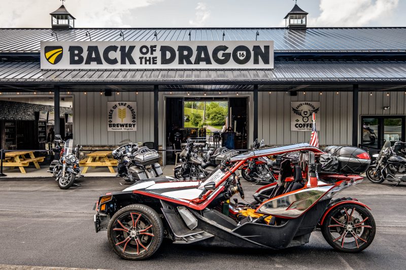
Sports car roads Virginia featuring a performance car driving Back of the Dragon near Tazewell

Frequently Asked Questions

Is Back of the Dragon good for sports cars?

Yes. Back of the Dragon offers more than 400 curves, elevation changes, mountain scenery, and technical driving sections that appeal to sports car and grand touring enthusiasts.

Can exotic cars drive Virginia Route 16?

Yes. The paved Virginia Route 16 corridor accommodates exotic cars, sports cars, touring vehicles, and scenic-driving enthusiasts seeking a memorable mountain driving experience.

What is the best sports car road in Virginia?

Many enthusiasts consider Back of the Dragon one of the best sports car roads in Virginia because of its combination of curves, elevation changes, scenic overlooks, and Appalachian mountain setting.

When is the best time to drive Back of the Dragon?

Spring and fall are generally considered the best seasons. These periods provide comfortable temperatures, excellent visibility, and some of the most impressive scenery along Clinch Mountain.

How long does the drive take?

Most visitors can complete the route in under an hour without stops. Many drivers choose to spend several hours exploring overlooks, scenic detours, and nearby destinations throughout Southwest Virginia.

Plan Your Back of the Dragon Sports Car Adventure

Back of the Dragon continues to attract sports car owners, grand touring enthusiasts, and exotic vehicle drivers looking for something more engaging than a typical scenic drive. The route combines mountain curves, elevation changes, Appalachian scenery, and a welcoming destination atmosphere that encourages visitors to slow down and enjoy the journey.

Whether you are planning a solo weekend drive, a club gathering, or a multi-day Appalachian road trip, Virginia Route 16 offers an experience that rewards both exploration and driver engagement.

Among the many sports car roads Virginia drivers can choose from, we continue to stand apart because of our combination of technical driving, Appalachian scenery, and destination-focused experiences. 

Start your adventure, discover the curves of Clinch Mountain, and experience why Back of the Dragon has become one of the most respected driving destinations on the East Coast.

Back of the Dragon
Privacy Overview

This website uses cookies so that we can provide you with the best user experience possible. Cookie information is stored in your browser and performs functions such as recognising you when you return to our website and helping our team to understand which sections of the website you find most interesting and useful.