
Back of the Dragon Map & GPX Download
The Road Awaits. Grab the Back of the Dragon map, load the Back of the Dragon GPX route, and get ready for Virginia Route 16 through Southwest Virginia. This run between Tazewell and Marion brings tight switchbacks, steep climbs, long drops, and the kind of curves riders talk about long after the engines cool.
A GPX route is a downloadable GPS file that helps riders and drivers follow a mapped route using a compatible navigation app or GPS device. For the Dragon, that means you can load the route before you get into the mountains, check the turns ahead of time, and keep your focus on the road instead of guessing at every bend.
This is for riders, sports car drivers, club leaders, and road-trip travelers who want to know the route before the engine warms up.
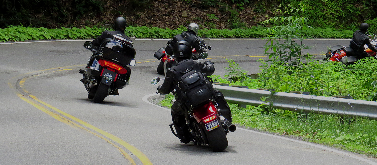
Download the Back of the Dragon GPX Route
The Back of the Dragon GPX route gives you a clean way to follow the main VA-16 ride without relying only on cell service. That matters here. Once you leave the town streets and start climbing into the mountain sections, service can fade, the road gets busy with curves, and stopping to fix a route on your phone gets old fast.
Load the GPX file into your GPS unit or route-planning app before you leave your hotel, cabin, or meet-up spot. If you are riding with a group, send the file out early so everyone has the same route saved before kickstands go up.
Keep a backup map handy, too. The Dragon has plenty of places where you will want your eyes up, not buried in a screen. A good route file keeps the day simple: start prepared, ride focused, and enjoy the road.
Back of the Dragon Route 16 GPS Map
The Route 16 GPS map helps you see the Dragon as a real mountain road, not just a line between two towns. From Tazewell, VA to Marion, VA, the route crosses rugged Southwest Virginia terrain with a mix of tight corners, sweepers, short straights, shaded pavement, and ridge-top views.
The ride carries you over three mountain ranges, including Clinch, Brushy, and Walker Mountain. That is why the route feels different from mile to mile. One section may open into a view across the Appalachian ridges. The next may tuck into tree cover with a sharp turn waiting on the other side.
Use the map to understand the flow before you ride. Check where you want to start, where you want to stop, and how much time you want to leave for photos, fuel, food, and a breather after the tighter sections.
For more trip details, visit Plan Your Trip.
Tazewell, VA Starting Point
Tazewell is the northern hub and a natural place to gather before the ride. Riders often meet near Main Street, check their route, grab food or drinks, and make sure the whole group is ready before heading south on VA-16.
Starting in Tazewell gives you the classic “roll out from town, climb into the mountains” feel. It also puts you close to the Back of the Dragon store, photos, merchandise, and the local rider energy that makes the route more than just pavement.
Marion, VA Southern Access
Marion gives riders and drivers a strong southern access point, especially if you are coming from I-81 or staying near Hungry Mother State Park. This side can feel like a quieter launch into the Dragon, with the road building from the Marion area into the mountain sections.
Some riders run Marion to Tazewell, then stop at the Back of the Dragon hub. Others start in Tazewell and finish near Marion before looping into the rest of Southwest Virginia. The GPX route helps either direction stay simple.
How to Use the Downloadable Ride Route
Download the GPX file before you reach the mountain corridor. Open it in your navigation app or GPS device, then confirm the route follows VA-16 between Tazewell and Marion. Do not wait until you are already on the shoulder trying to fix settings while your group is ready to roll.
For motorcycle clubs and sports car groups, share the route before the trip so the whole line knows the same plan before leaving town. On the Dragon, a photo stop, a slow-moving vehicle, or a regroup near one of the pull-off areas can spread riders out quickly. When everyone has the same route loaded, the day feels smoother and safer.
Use the map as a guide, not a substitute for road sense. The Dragon has curves that tighten quickly, shaded sections that can hold moisture longer, and grades that make speed feel different than it does on a flat road. Load the route, then ride the road in front of you.
What to Know Before Riding Route 16
Back of the Dragon rewards riders who respect the terrain. VA-16 is not a simple scenic bypass. It climbs, drops, and bends over mountain ground, with sections that ask for steady throttle control, clean braking, and patience through the tighter switchbacks.
Watch the shaded areas, especially after rain or during cooler mornings. Southwest Virginia weather can change fast in the ridges. A clear start in Tazewell can still turn into fog, damp pavement, or cooler air as the road climbs. In fall, leaves can collect in corners. After storms, small gravel and wash can show up where water crosses the road.
Before hitting the pavement, check the Virginia Department of Transportation 511 system for active road work, incidents, or seasonal maintenance updates on VA-16. First-time riders should also study the map, learn the shape of the route, and give themselves room. The best ride is the one where you enjoy the corners, take in the overlooks, and still have enough energy left to talk about it afterward.
For more first-time guidance, read Back of the Dragon Safety Tips for First-Time Riders.
Why Choose Back of the Dragon for Your Route Planning
Back of the Dragon is not just a road name on a GPS screen. It is a Southwest Virginia riding destination shaped by the towns, mountains, businesses, and riders who keep coming back.
Planning through the official Back of the Dragon experience gives you more than a route file. You can connect the map with lodging, trailer parking, food, drinks, ride photos, group trip planning, and the Main Street stop in Tazewell. That local context helps, especially if you are bringing a club or traveling in from out of state.
A generic map can point you toward VA-16. Back of the Dragon helps you understand how the ride fits together: where to meet, where to start, what the road feels like, and how to build a full day around the Dragon instead of rushing through it.
To learn more about the road itself, visit The Road. To see how the Dragon became a Southwest Virginia riding destination, visit Our Story.

Plan Your Back of the Dragon Trip
A good Dragon run starts before the first curve. Once your map and GPX route are ready, think through the rest of the day: where you are staying, where the group is meeting, where you will park, and whether you want to ride the route one way or build a loop through Southwest Virginia.
Riders often plan around Tazewell, Marion, Hungry Mother State Park, Burke’s Garden, and nearby Appalachian backroads. If you are trailering bikes or traveling with a car club, sort out parking and lodging before you arrive. It keeps the morning easier and gives you more time for the ride.
Leave room in the schedule for more than pavement. Stop for photos, grab pizza or a drink, check out the store, and give yourself time to cool down after the mountain sections. The Dragon is the main event, but the towns and stops are part of the story.
Service Area
Back of the Dragon serves riders, drivers, clubs, and road-trip travelers visiting Southwest Virginia for the VA-16 route between Tazewell and Marion.
The core route connects the Tazewell side of the mountains with the Marion side near Hungry Mother State Park. Many visitors also build the trip around Burke’s Garden, Clinch Mountain, and the Jefferson National Forest, part of the George Washington and Jefferson National Forests managed by the U.S. Forest Service. That public-land setting is part of what gives this region its wooded ridges, quiet backroads, and true Appalachian feel.
If you are coming from outside the region, load the GPX route before you arrive and check your day plan while you still have strong service. The road is easy to find when you know where you are going, but the mountain setting makes preparation part of the ride.
Frequently Asked Questions
Where can I find the Back of the Dragon map?
You can use the Back of the Dragon map to plan the VA-16 ride through Southwest Virginia. It helps you see the full run between the Tazewell and Marion access points before you arrive. Riders use it to plan meet-up spots, stops, direction of travel, and timing for the day.
Can I download a Back of the Dragon GPX file?
Yes. The Back of the Dragon GPX file gives you a downloadable ride route for compatible GPS devices and navigation apps. Save it before your trip, open it once to make sure it loads, and keep a backup map in case service drops in the mountain sections.
What road is Back of the Dragon on?
Back of the Dragon follows Virginia Route 16 in Southwest Virginia. The road is known for mountain grades, switchbacks, hairpins, scenic views, and hundreds of curves. It is popular with motorcycle riders, sports car drivers, and group road trips.
Where does Back of the Dragon start and end?
The route runs between Tazewell, VA and Marion, VA. Tazewell is the northern hub with the Back of the Dragon stop on Main Street. Marion gives riders southern access near I-81 and Hungry Mother State Park.
Is the Route 16 GPS map helpful for first-time riders?
Yes. The Route 16 GPS map is especially helpful if you have never ridden the Dragon before. It lets you understand the direction, length, access points, and mountain layout before you arrive. First-time riders should still ride at their own pace and treat the map as a planning tool, not a reason to rush.
Ride the Dragon Your Way
Load the map. Download the GPX route. Check your stops. Then come ride the mountain road that keeps Southwest Virginia on the bucket list for riders and drivers.
Back of the Dragon is for people who love curves, clean mountain air, small-town stops, and a road that feels earned by the time you finish it.